What Is Building Intelligence?
A guide for property managers and facility teams on moving from one-time inspections to reusable building condition data.
Read the article →Know your buildings before problems become expensive. AerialSpect uses drone data collection, 3D digital twins, and inspection-ready workflows to turn exterior building conditions into clear, usable intelligence.
US operation of Aeroscan Netherlands — market leader in digital building inspection
Whether you manage commercial buildings, industrial warehouses, multifamily communities, HOA portfolios, campuses, or infrastructure assets — AerialSpect gives you repeatable inspection data across the properties you are responsible for.
Precision asset oversight and predictive capital planning for office, retail, and mixed-use portfolios across the Twin Cities.
Learn more → Commercial proof: AHAM Vastgoed →
Large-footprint industrial roofs and facades — inspected faster and cheaper than any traditional method, with thermal imaging for leak detection.
Learn more → Campus proof: Erasmus University →
Portfolio-wide consistency for multi-family and HOA communities — proactive safety identification and standardized documentation across every property.
Learn more → Housing proof: WoonFriesland →AerialSpect serves US facility managers, commercial real estate operators, multifamily owners, HOA boards, industrial asset managers, campus facilities teams, and infrastructure operators that need defensible exterior building data.
Exterior facade, roof, and condition documentation for office, retail, mixed-use, and historic commercial properties.
See AHAM Vastgoed case study →Repeatable inspection workflows for residential portfolios where consistency, resident communication, and board-ready reporting matter.
See WoonFriesland case study →Digital twins for rail stations, universities, hospitals, and facilities where access, safety, and disruption control are critical.
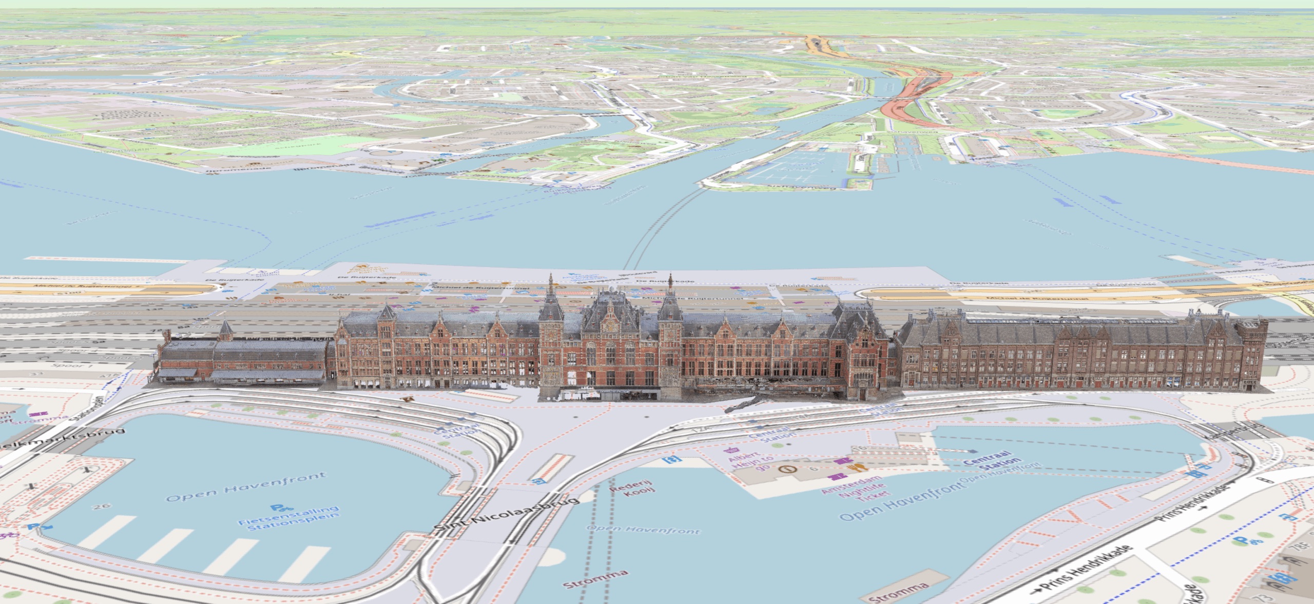
See NS Railways case study →Dutch national rail operator NS commissioned Aeroscan to create a full digital twin of Utrecht Central Station — one of the busiest transit hubs in Europe. Using a custom 2-meter "super drone" and LiDAR technology, the entire exterior was mapped without disrupting passenger flow.
Real outcomes from Aeroscan's 8+ years of European operations — the same inspection platform and workflow now available through AerialSpect in the US.
A facade inspection using traditional rope access and swing stages costs thousands per day. A single drone flight covers the same ground in hours — at a fraction of the price.
Inspection reports that took teams weeks to compile are now generated automatically from drone-captured data. Your facility managers get more time for decisions, not documentation.
Thermal imaging catches membrane failures, moisture infiltration, and structural issues before they cause interior damage. Catching it early costs a fraction of emergency remediation.
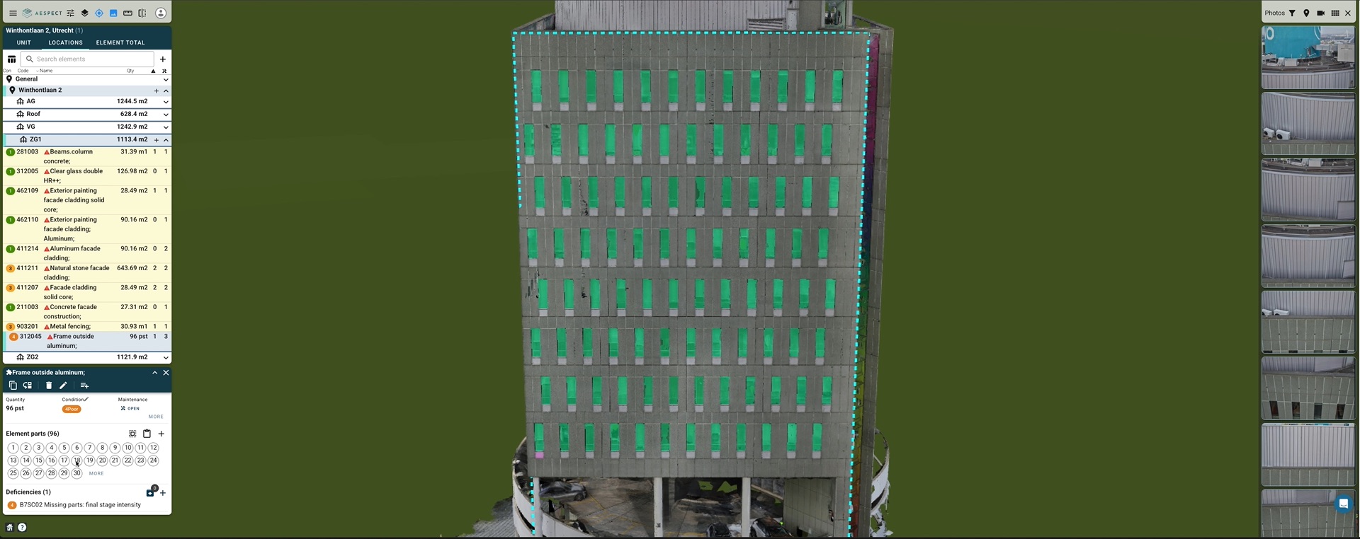
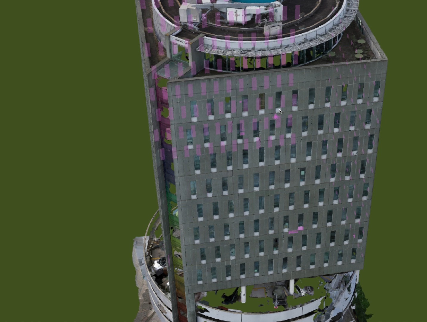
Drone-captured photogrammetry captures 4x more measurable data points per square foot than traditional walkthroughs — meaning nothing gets missed and every finding is defensible.
AerialSpect is not just a drone inspection service. The larger shift is building intelligence: turning exterior condition data into a reusable record property teams can actually use.
A guide for property managers and facility teams on moving from one-time inspections to reusable building condition data.
Read the article →Join the property managers nationwide who are replacing manual inspection with digital certainty.
Questions? Call us: +1 (612) 450-2856