The Challenge
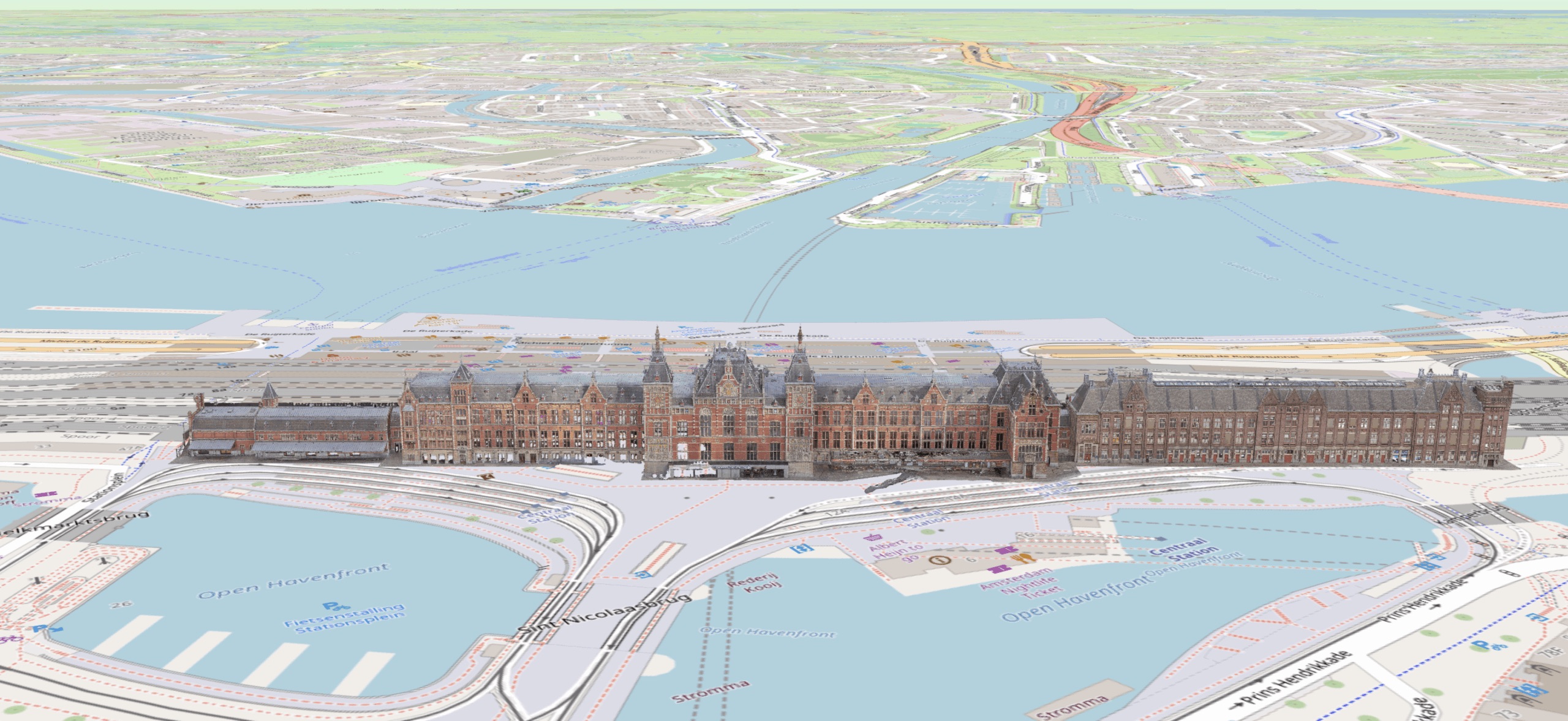
Utrecht Central Station is one of the busiest transit hubs in Europe, handling over 89,000 passengers daily. NS, the Dutch national rail operator, needed a comprehensive exterior condition assessment of the station complex — including the main hall roof, platform canopies, and connecting walkways.
Traditional inspection methods would have required scaffolding on active platforms, partial station closures, and weeks of disruption to passenger flow. The station's complex geometry — curved glass canopies, multi-level platforms, and elevated walkways — made conventional access even more challenging and expensive.
The Solution
Aeroscan designed a custom 2-meter wingspan "super drone" equipped with survey-grade LiDAR sensors specifically for this project. The larger platform provided the stability needed for millimeter-accurate scans in the turbulent air conditions created by the station's architecture and passing trains.
The entire exterior was captured in a single 3-hour session during normal operating hours. No platforms were closed. No passengers were redirected. The drone operated above the roofline, capturing every surface from multiple angles while the station functioned normally below.
- Custom 2-meter LiDAR drone designed for the project
- Survey-grade sensors achieving 0.3mm accuracy
- Complete exterior capture in one 3-hour session
- Zero disruption to passenger operations
- All data processed into a navigable 3D digital twin
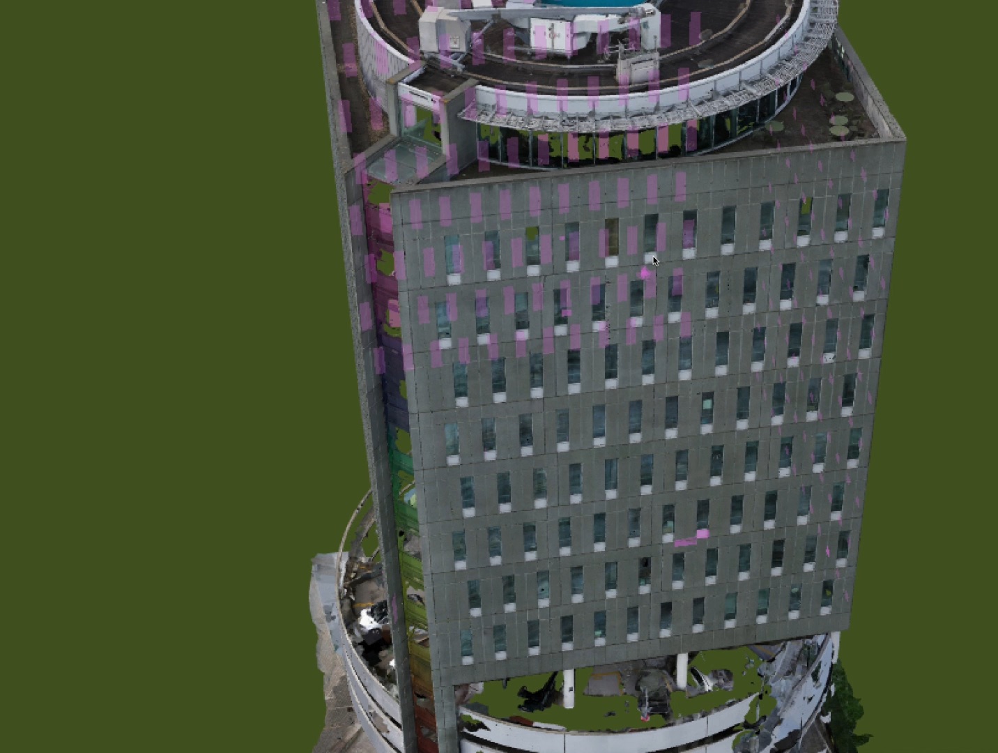
The Results
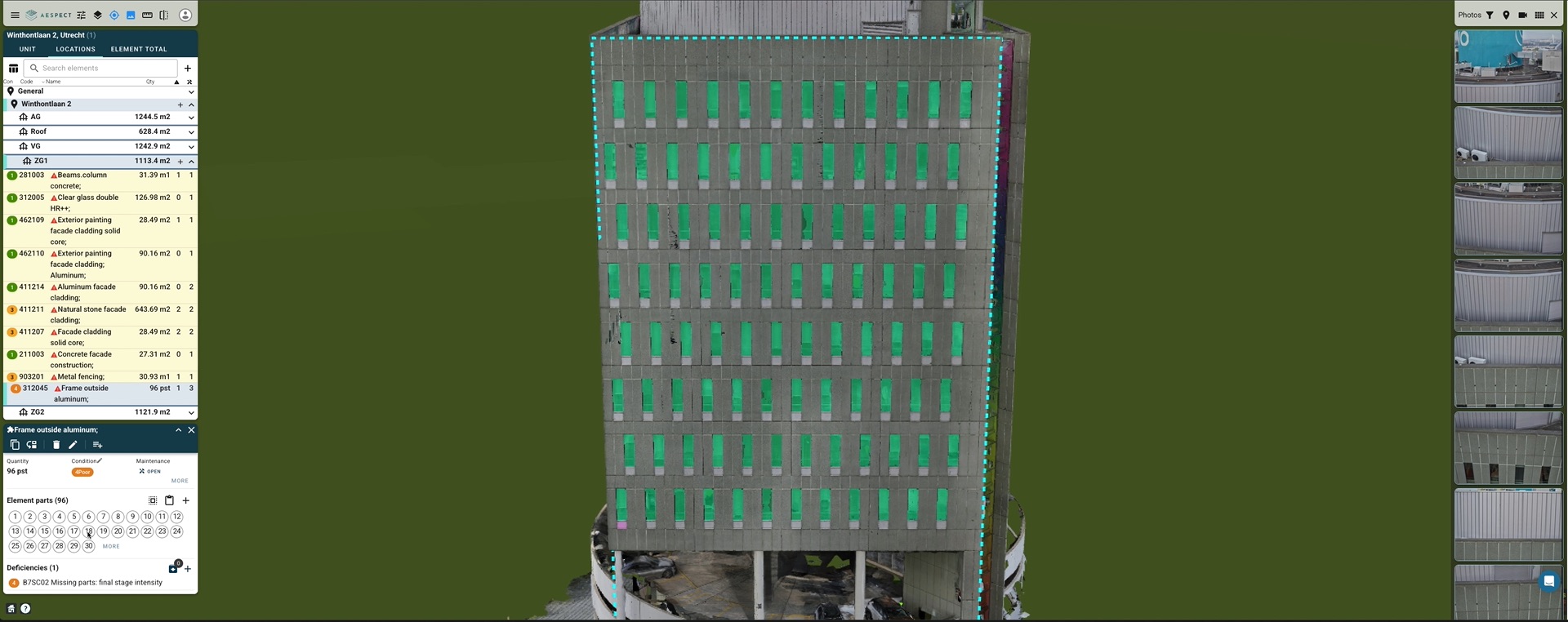
NS received a millimeter-accurate 3D digital twin of the entire station complex, accessible through the Aespect cloud platform. Facilities managers can now virtually navigate every exterior surface, measure distances between structural elements, and annotate areas of concern — all from their desks.
The digital twin has become a living maintenance tool. Condition changes are tracked over time by comparing annual re-scans. Contractors receive precise location data and measurements before arriving on site, eliminating the back-and-forth of traditional inspection workflows. The model is shared across departments with role-based access controls, so structural engineers, cleaning crews, and project managers all see the data relevant to their work.
Why This Matters for US Properties
The same technology that mapped one of Europe's most complex transit hubs is now available for commercial and institutional buildings across the United States. Whether you manage a single office tower or a campus of buildings, AerialSpect delivers the same level of precision, speed, and zero-disruption capture that NS Railways trusted for their most critical infrastructure.