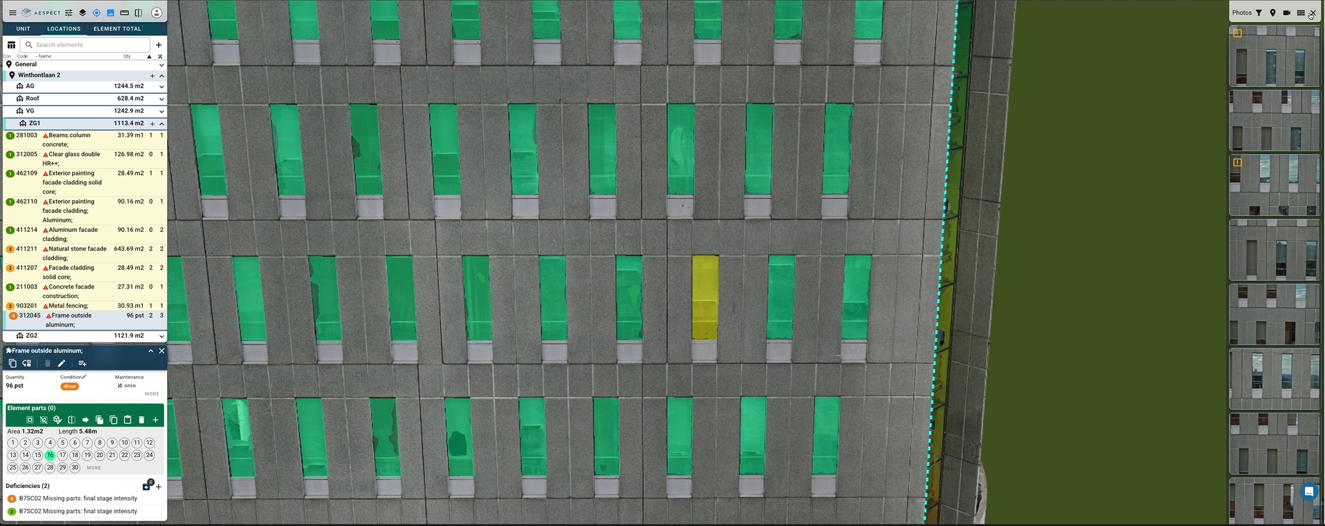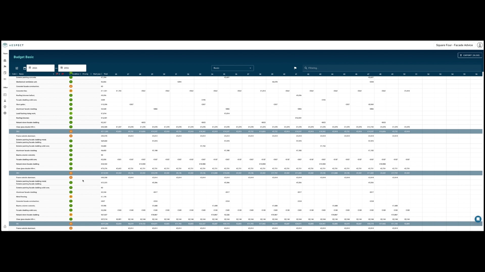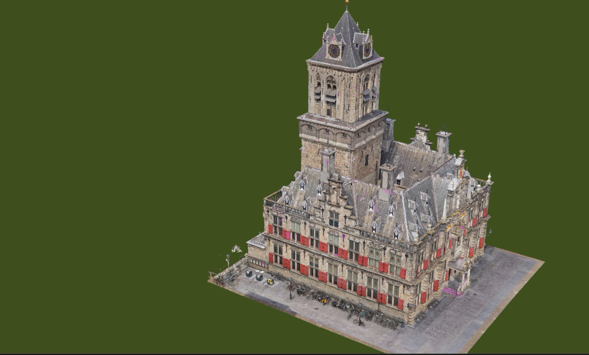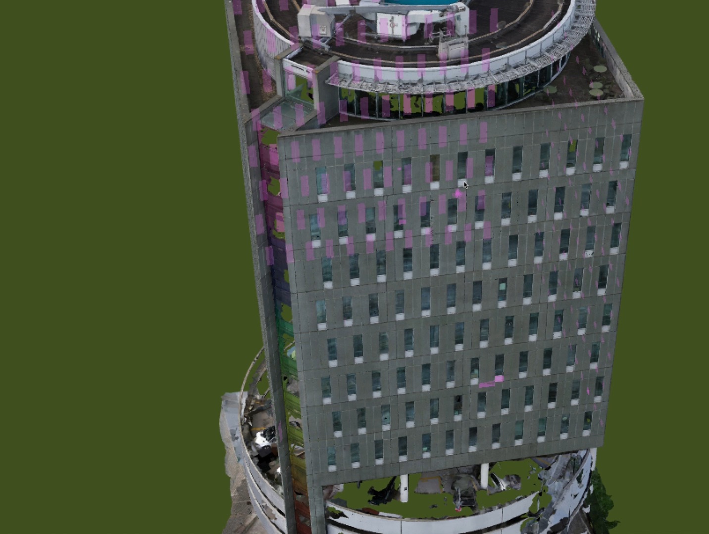
Commercial Portfolios
Office buildings, retail centers, and mixed-use properties. We capture every exterior surface and deliver a complete digital record your asset management team can use for years.
- Roof & facade digital inspection
- Millimeter-accurate 3D models
- Multi-year CapEx forecasting
- Insurance-ready documentation
- Compliance reporting
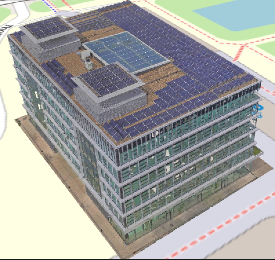
Industrial & Warehouse
Large-footprint roofs are expensive and dangerous to inspect manually. Our drones cover 100,000+ sq ft in a single flight, capturing thermal and visual data across every membrane seam and penetration.
- Thermal membrane inspection
- HVAC penetration analysis
- Structural condition assessment
- Tenant-ready reporting
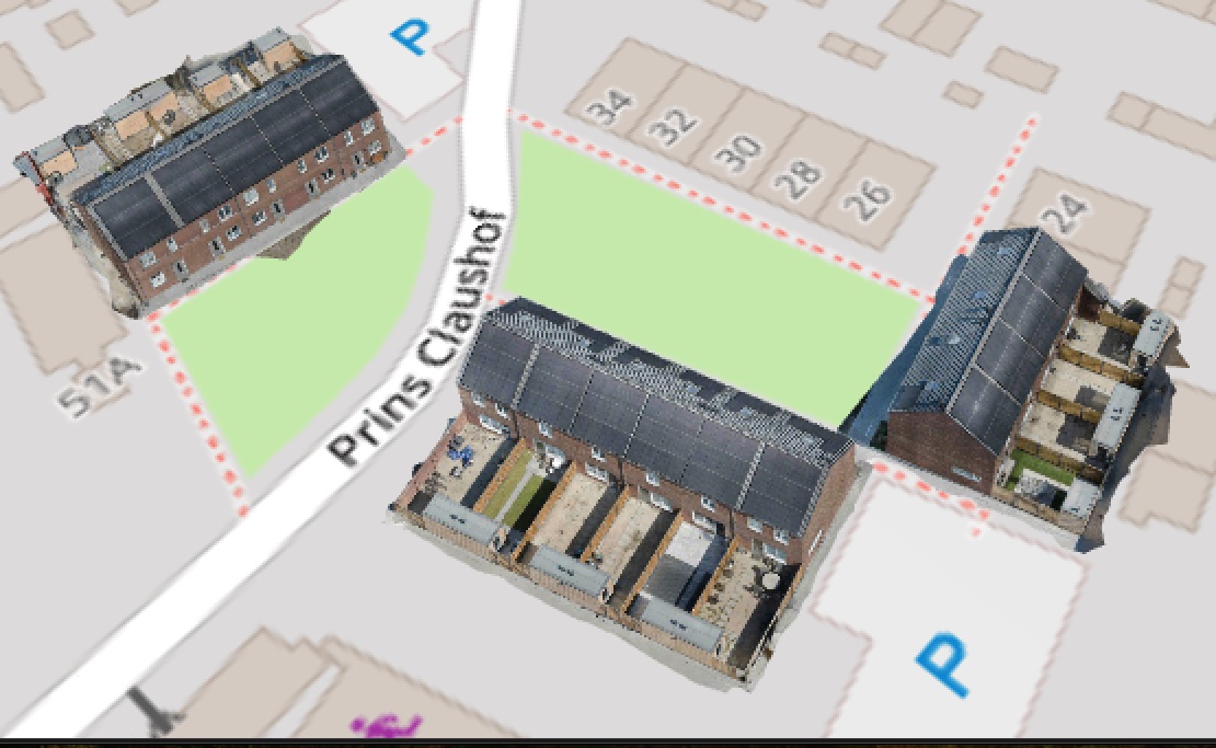
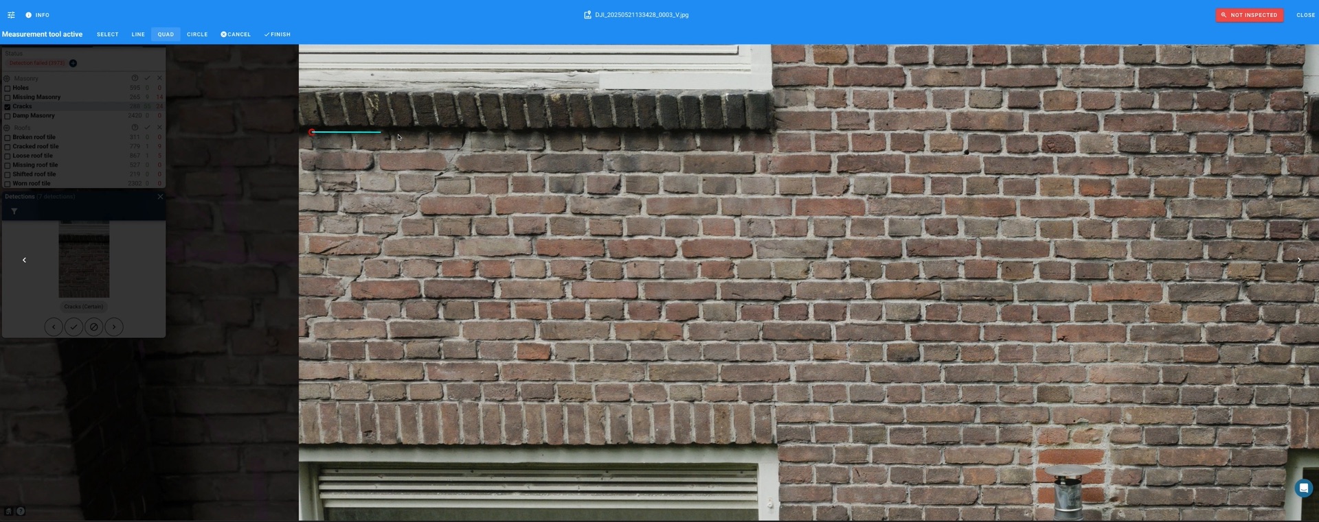
Residential Portfolios
Multi-family communities, HOA campuses, and condo associations. Give your board a clear, visual picture of building conditions and a data-backed plan for reserve spending.
- HOA reserve study support
- Safety risk identification
- Board-ready visual reports
- Budget stability planning